Flooding Processes
U.S. Shorelines: iFlood is being used to study coastal flooding owing to interactions among marine processes (tides, storm surge, waves, wind-driven setup), precipitation and overland flows (downhill drainage), groundwater processes (a high water table prevents infiltration and the groundwater can absorb and transmit ocean water to inland areas), high riverine water levels (spring freshets), and local snow melt and ice blocking along several U.S. shorelines.
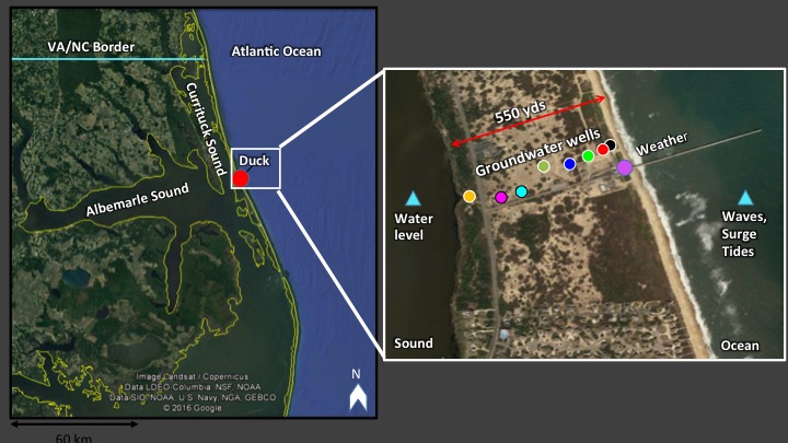
Outer Banks, NC: We are studying flooding owing to ocean waves and surge, groundwater, and precipitation using observations of the water levels in the surface aquifer that we have been collecting at the US Army Corps of Engineers Field Research Facility near Duck, NC since September 2014. The measurements are being used to develop a simplified model for the increase in groundwater levels owing to rainfall, as well as the propagation of groundwater bulges resulting from infiltration of ocean and sound water during storms.
